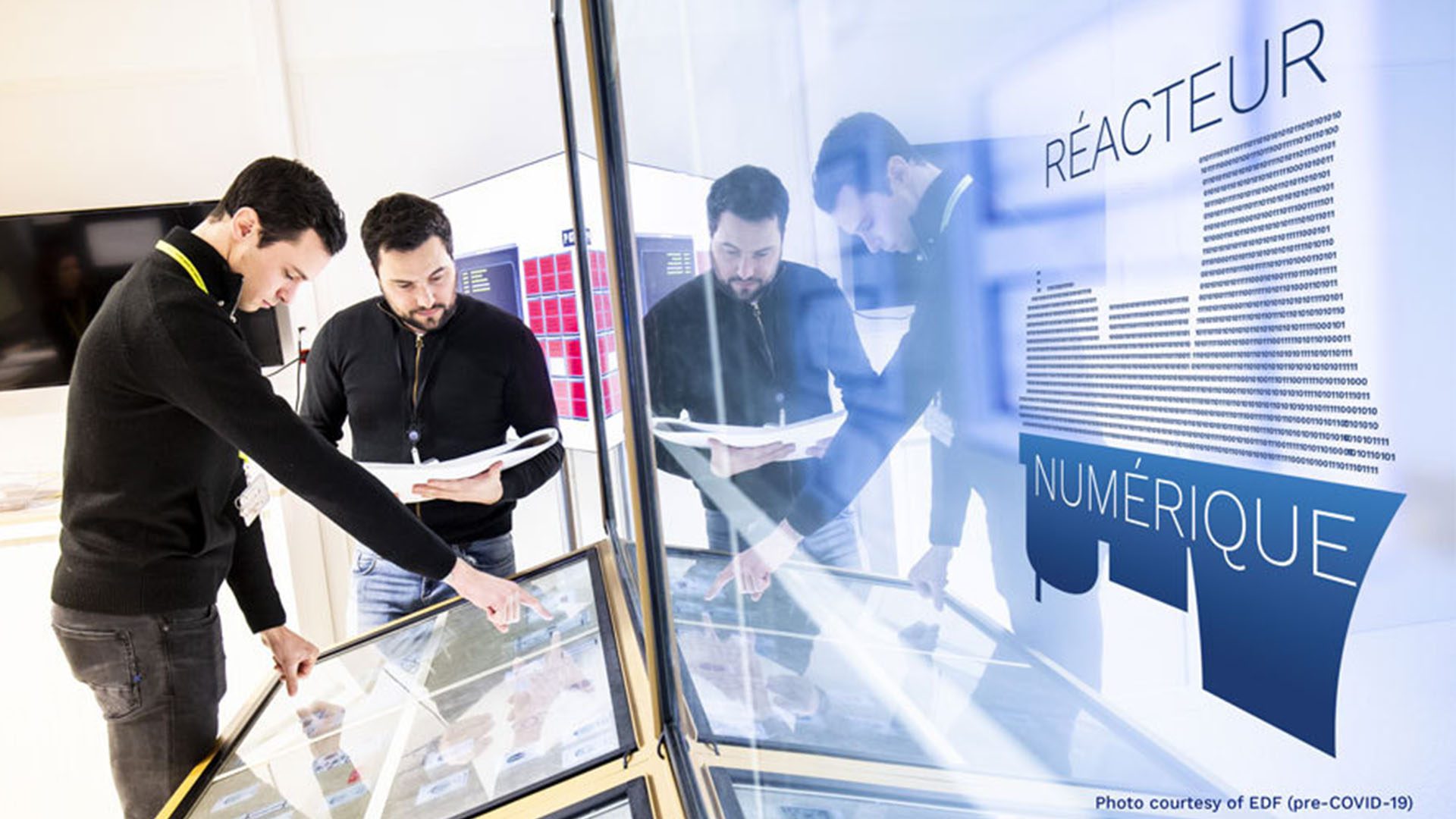
In the largest underwater 3D capture project ever undertaken, researchers have created the first full-size 3D scan of the Titanic. The Titanic’s digital twin depicts the aftermath of the disaster to a level of detail and clarity that has never been seen before.
A Titanic Project
The 3D capture scans were taken during a six-week expedition in the summer of 2022 by deep water specialist company Magellan Ltd. The project was carried out with media partner Atlantic Productions, who is making a documentary about the scans and the Titanic.
To capture the shipwreck in its entirety, two remote-controlled submersibles mapped every millimeter of the wreck in minute detail, including the entire 3-mile debris field. The submersibles spent over 200 hours at 12,500 feet below the surface to take over 700,000 images from every angle. They were deployed by a team on board a specialist ship that was positioned in the North Atlantic, 435 miles off the coast of Canada.
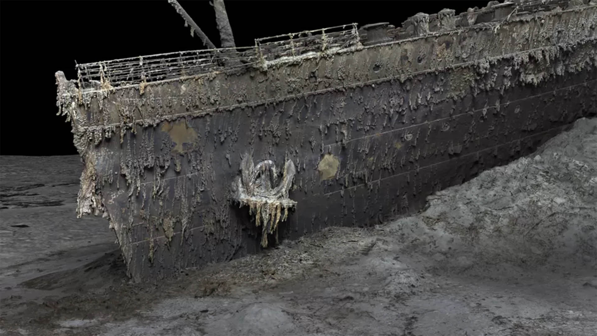
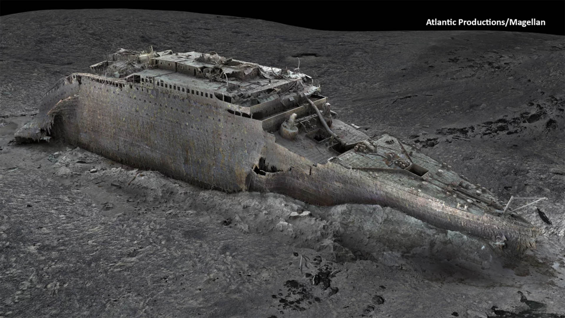
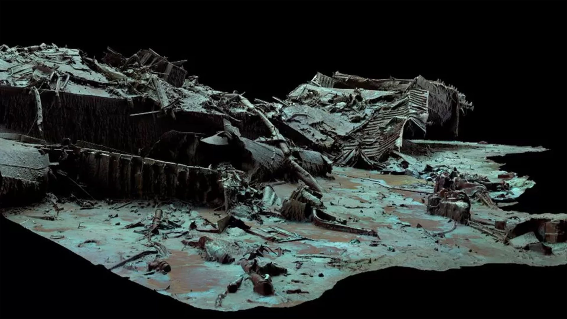
The ship now lies in two parts on the ocean floor; the bow and stern are separated by about 2,600 feet. As clear in the above image, the ship’s bow is still instantly recognizable. The stern, however, is a “chaotic tangle of steel” because this part of the ship collapsed as it sank into the sea floor. In the scan, items can also be identified in the surrounding debris field, such as unopened champagne bottles, dozens of shoes, and statues.
In accordance with the tight regulations that surround the wreck, nothing was touched or disturbed at any point. According to the company, the site was also treated with the utmost respect, which included a flower-laying ceremony in memory of those who lost their lives.
The Scan’s Importance
Advertisement
The digital twin will offer new insight into what happened to the Titanic. As explained by Titanic analyst Parks Stephenson, “We really don’t understand the character of the collision with the iceberg.” In the movies, the Titanic was hit along the starboard side, but this has not been confirmed. The ship could have grounded on the iceberg, for example. Studying the stern in the digital twin could help inform researchers exactly how the ship hit the seafloor.
This project is as important as ever because the ship is slowly disintegrating underwater because of rust, microbes, and more. The scan freezes the wreck in time, allowing experts to analyze every detail for years to come.
Additionally, the scans will inform researchers about how to better preserve the other hundreds of thousands of deep-sea shipwrecks around the world, from ancient wooden ships to World War II vessels. Jeremy Weirich, the director of the National Oceanic and Atmospheric Administration’s Ocean exploration program, explained that the scan’s findings on things like the rate of deterioration and the microbial environment can be applied to other sites. The technology could also provide more information about deep sea environments in general, such as geological features and unknown species.
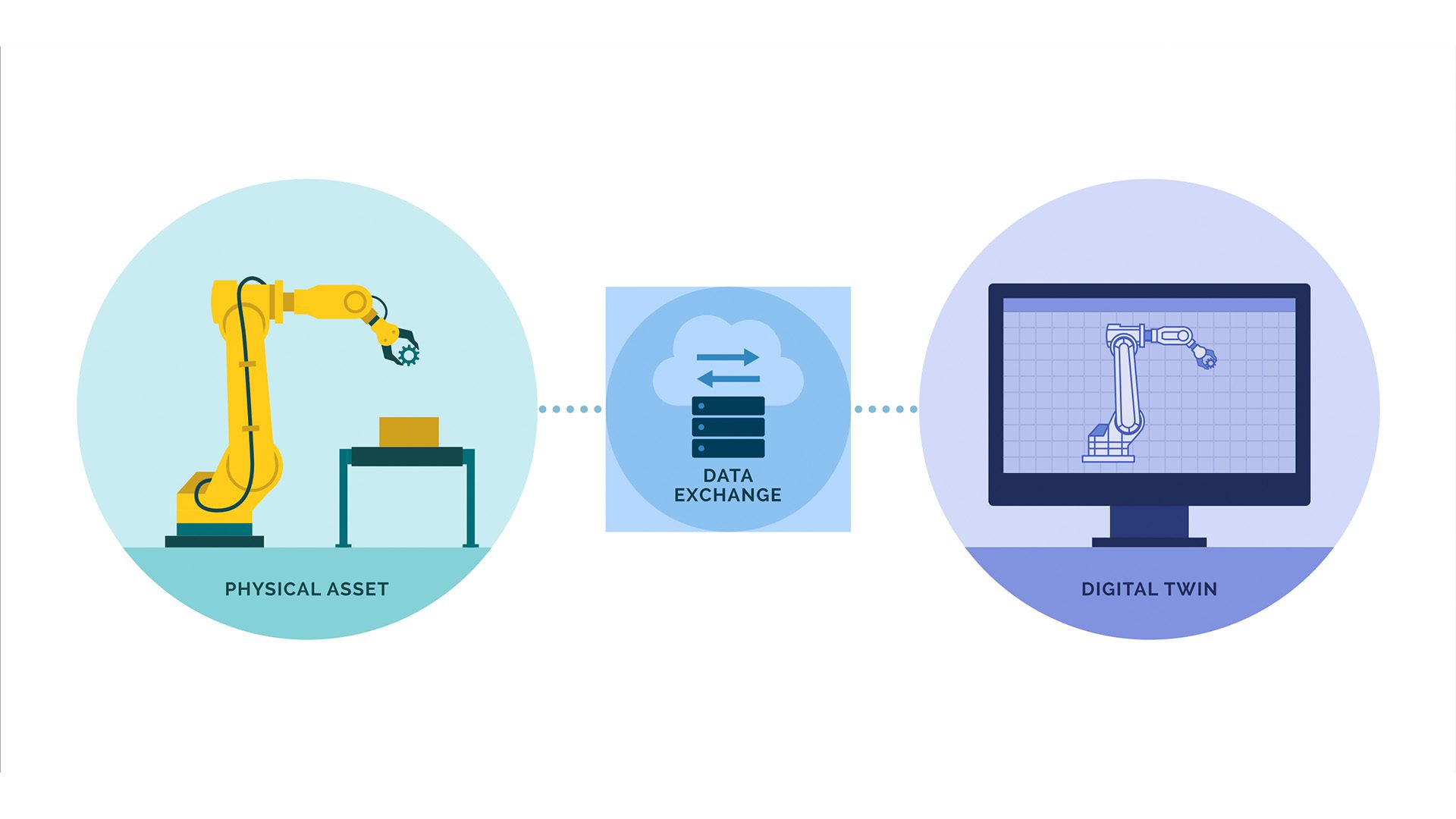
Digital Twin Applications
In addition to scanning the Titanic’s shipwreck, digital twin technology is used to 3D replicate many structures, locations, and people for a wide variety of industries. The NFL, for example, uses digital twins to create a virtual representation of an NFL player to better predict and prevent player injury. Some NFL stadiums also use a virtual model of the building to support daily management and game day operations.
Architects use digital twins to improve efficiency and safety. TK Elevator, in collaboration with Microsoft Azure, used a digital twin to create the world’s first ropeless elevator for a high-rise building. The digital twin simulated different situations, like testing emergency brakes, that would have been costly and time-consuming in the physical world.
Lockheed Martin and NVIDIA are even creating a digital twin of Earth’s atmosphere. The project, titled Earth Observations Digital Twin, will monitor current global environmental conditions and predict weather patterns. Unlike what is used now, the data will be a timely, global visualization of the current atmosphere, not a forecast model.