We often find ourselves thinking about how lost we’d be without the technology featured in this TWT episode (quite literally). During this segment, Tamara took a trip to Eastman and learned about the advancements in car coatings. She saw demonstrations of how they’re making cars more scratch-resistant and even listened to theories on how coatings will play a role in self-driving technology. Afterward, Tamara journeyed to Microsemi and CableLabs in order to learn about the latest in GPS technology. She even journeyed back to visit her friends at Chiquita so they could show her how GPS plays a role in farming. We learned quite a bit about the most useful purposes of modern GPS systems, but did you know there are a lot of lesser known uses as well?

Preventing Shark Attacks
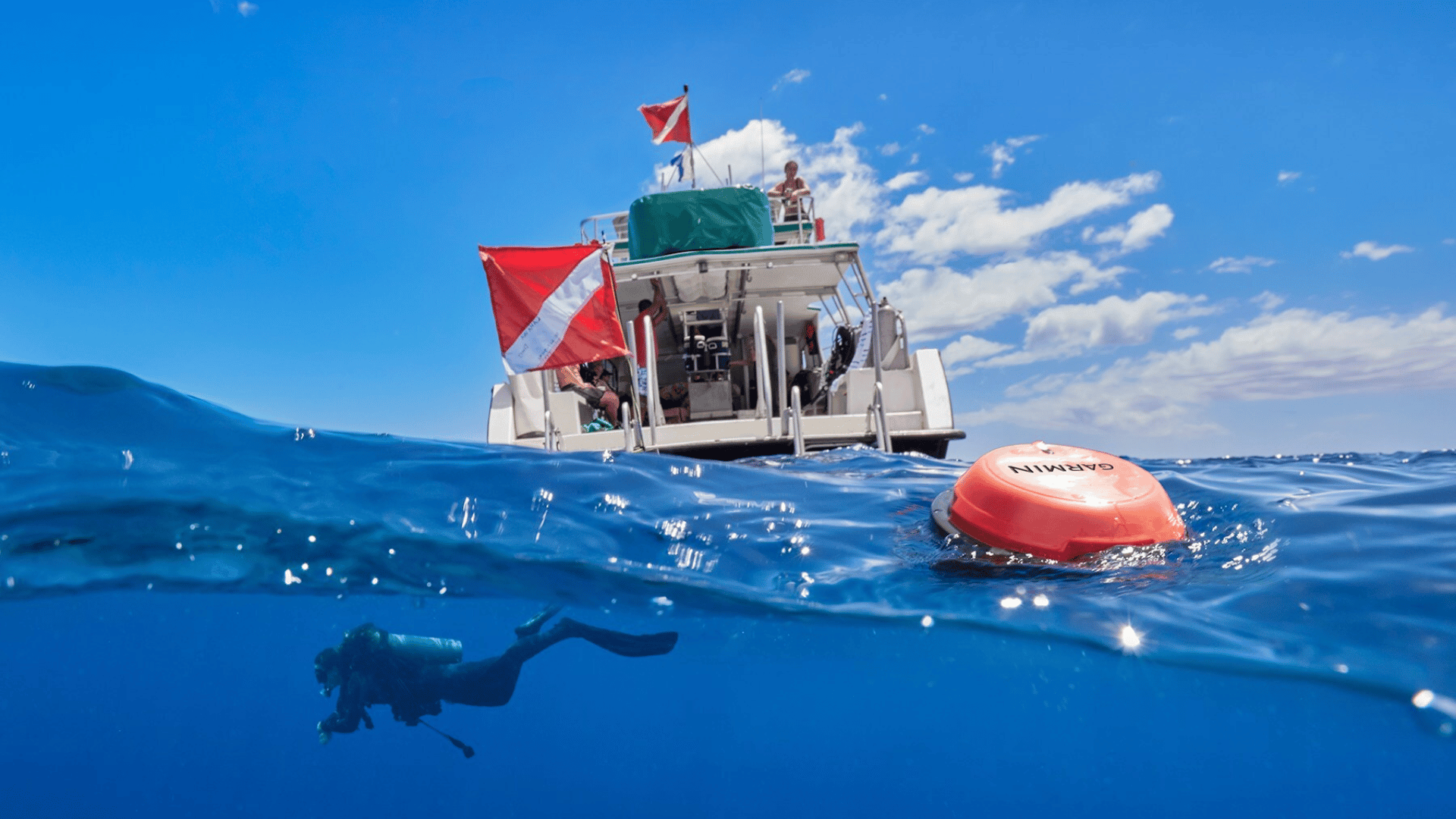
It may reassure beachgoers to hear that GPS technology is being utilized in an attempt to prevent future shark attacks. A data collecting ocean research organization called OCEARCH is tagging sharks with GPS devices so they can monitor their locations in the ocean. This way, if they ever come close to shore, they can alert lifeguards who can implement proper safety procedures accordingly. The GPS devices also allow researchers to get a sense of different species of aquatic life and their various patterns and movements.
Investigating Cats
This header may have left you scratching your head, but a group of researchers from the North Carolina Museum of Natural Sciences and NCU are attempting to answer the age-old question: what do cats do when we’re not around? The initiative was dubbed The Cat Tracker Project and was originally started back in 2014 and prompted by a study by Nature Communications which suggested outdoor cats are responsible for somewhere between 1.4 and 3.7 million bird deaths each year. They’re attempting to gauge if that information is accurate, while also recording outdoor cat’s habits and behaviors to see if they can better understand our furry companions.

Self-Driving Cars
TWT discusses both driverless cars and GPS on this episode separately, but the two are also intricately intertwined. The accuracy and ability to mimic human drivers in terms of safety requires a combination of sensors, cameras, and (of course) GPS technology. GPS maps are used to plot the car’s location, direction, and speed- while the cameras are responsible for scanning traffic lights and other visual markers. As you can imagine, in order for these cars to be safe to use the GPS map must be created with an incredible amount of detail and accuracy.
SmartSoles
For people who have relatives or friends with autism, Alzheimer’s, dementia, or a form of brain injury- GPS technology is here to help. If you’re worried about the possibility of your loved one accidentally wandering off, the SmartSole uses a GPS device hidden and sealed in a trim-able shoe insole to help you keep track of them. This is especially helpful as you can set a perimeter where you will be alerted if your loved one steps outside of it.
From helping make farming technology more energy-efficient to keeping your disabled loved ones safer, GPS systems aren’t just good- they’re navi-great!