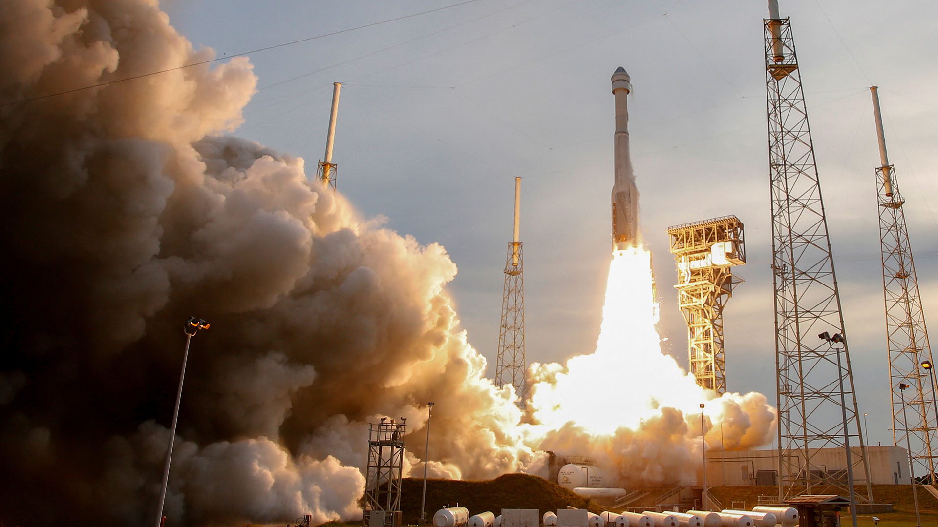
In early April, NASA’s TEMPO (Tropospheric Emissions: Monitoring of Pollution) instrument will launch from the Kennedy Space Center. The satellite mission will detect and measure air pollution over North America in real time by using the spectrum of light.
Mission Background
TEMPO is NASA’s first Earth Venture Instrument mission, and it will be the first satellite instrument to make hourly daytime observations of air quality over North America. Specifically, it will measure air pollution from Mexico City to the Canadian oil sands, and from the Atlantic to the Pacific.
Most orbiting air-quality monitoring systems observe air pollution at a particular location once a day. However, air pollution levels vary greatly throughout the day. Additionally, many areas are not currently monitored and are expected to violate proposed ozone standards. TEMPO, on the other hand, will track the evolving variations in air pollutants every daylight hour of the day across all of North America.
TEMPO is a collaboration between NASA and the Smithsonian Astrophysical Observatory. Its technology has been developing for over 30 years, and the mission itself was proposed a decade ago.
TEMPO’s Instrument and Data
The instrument will launch from Cape Canaveral Space Force Station on a SpaceX Falcon 9 two-stage rocket to a geostationary orbit on a commercial communications satellite Intelsat 40e. This means that the satellite will remain 22,235 miles directly over North America.
Advertisement
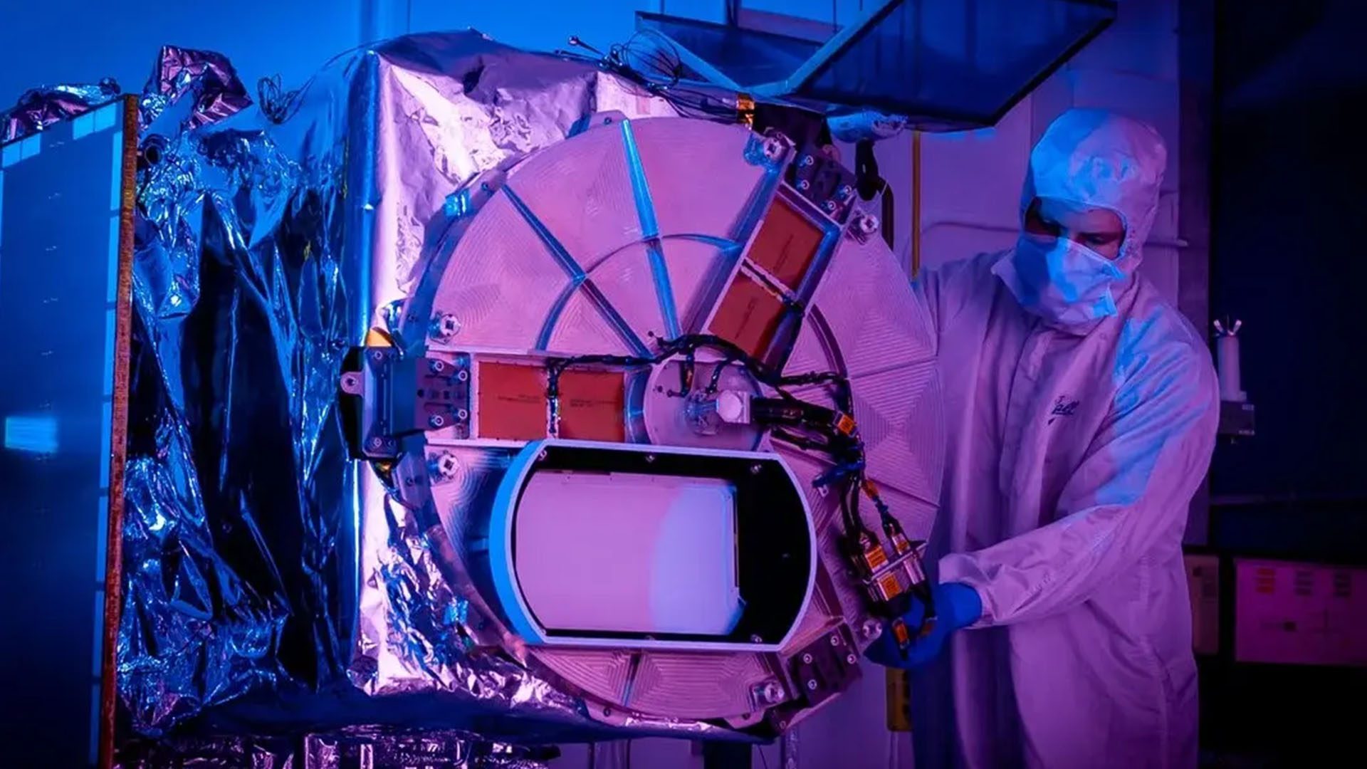
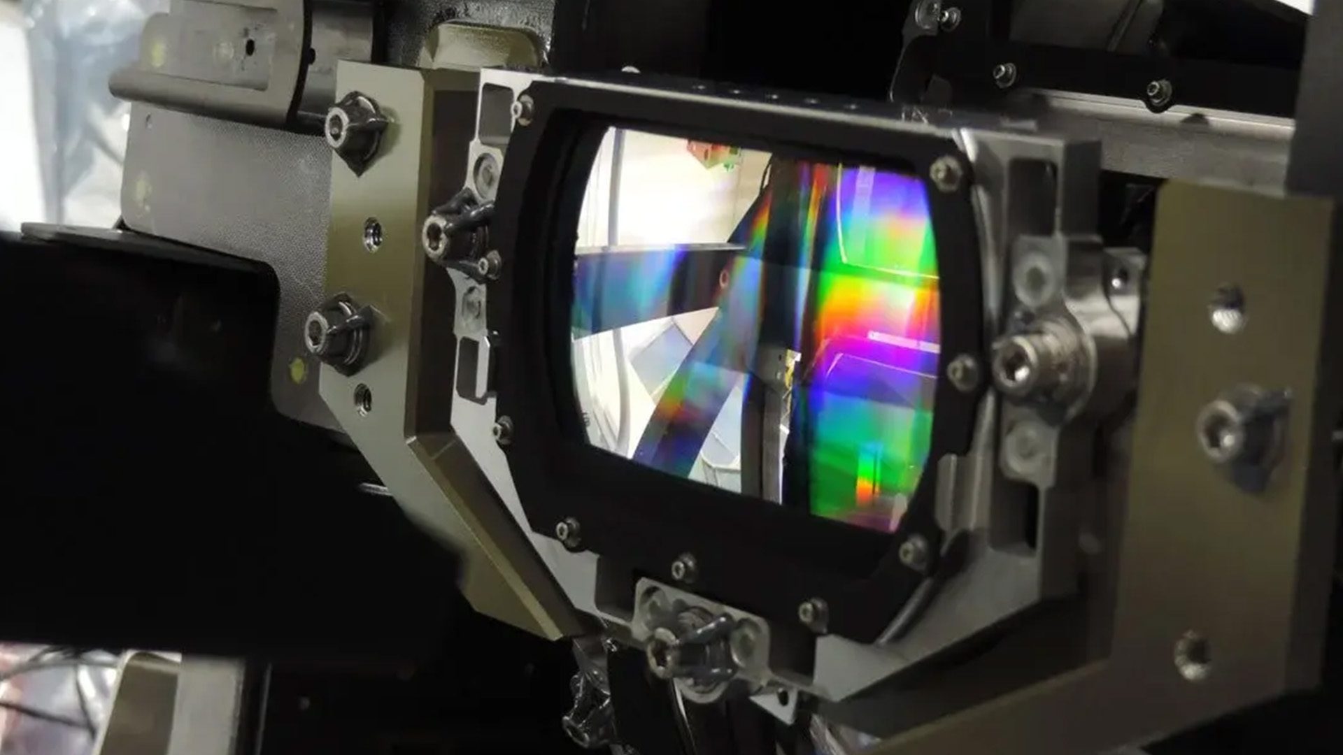
The instrument is a grating spectrometer that is sensitive to both visible and ultraviolet wavelengths of light. The system’s light-collecting mirror will make a complete east-to-west scan of the continent by measuring the sunlight reflected and scattered from the Earth’s surface and atmosphere back to the instrument’s detectors. TEMPO’s ultraviolet and visible light sensors will be able to monitor daily variations in ozone, nitrogen dioxide, sulfur dioxide, formaldehyde, and aerosols in the troposphere.
The collected stream of data will enable researchers to “…improve pollution emission inventories, monitor population exposure, and evaluate effective emission-control strategies.” By identifying the where, what, and when of air pollution in extreme detail, TEMPO can help guide how to mitigate the harmful effects of pollution at the source.
The mission will also provide air quality products that will be made publicly available and will improve air quality forecasting. For example, TEMPO can deliver air quality forecasting across the continent to alert the public when levels of particulate matter, volatile organic compounds, and more are particularly high. People in most of North America currently have no resources to know when their local air is clean.
Additionally, the instrument’s optical system will be able to provide local detail with its spatial resolution of four square miles. In comparison, current satellite capabilities have a spatial resolution of about 155 square miles. This enables TEMPO to directly identify higher or lower areas of pollution and pinpoint specific sources of air pollutants, such as factories or farms.
Similar Ventures
TEMPO’s North America scale is part of a larger picture of other pollution-monitoring satellites around the world. For example, the Korea Aerospace Research Institute launched a satellite in 2020, and the European Space Agency plans to launch another one next year. Together, the satellites will scan air pollution levels across Europe, North America, and Asia.